Diversity Gazetteer

Tutorial - query results
Pressing the  button will display all places
in the list box which matches the query conditions and the selected
maximal number of results:
button will display all places
in the list box which matches the query conditions and the selected
maximal number of results:
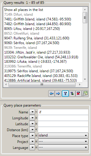
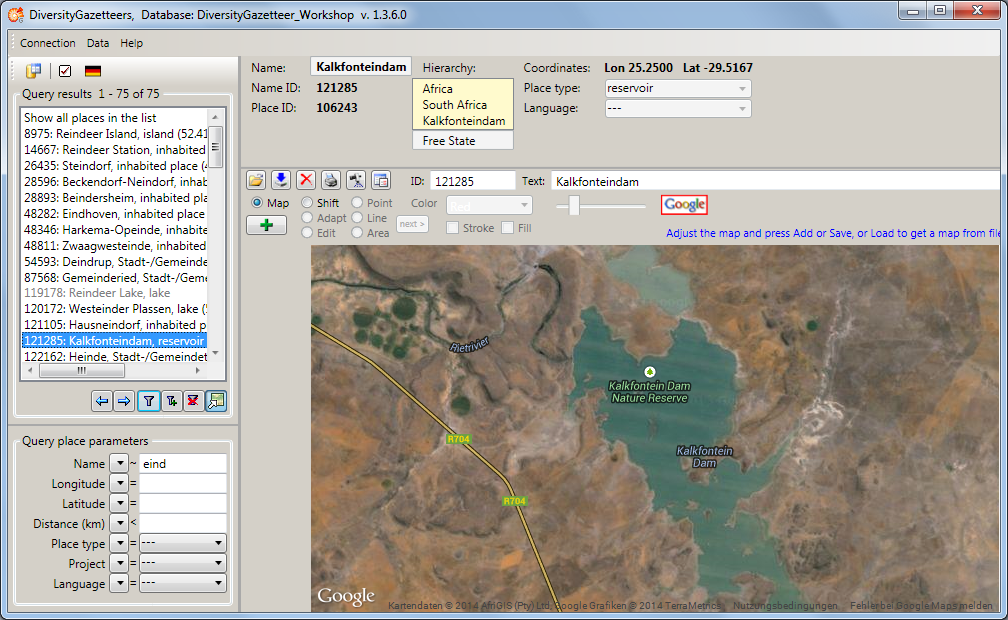
The entries consist of name ID, name, place type and coordinates (if any). If no coordinates are available, the entry is shown in gray. In case the entry describes a complex geography (e.g. a country polygon, a river line string etc.), the coordinates represent the “envelope center” of the shape.
The indices of the currently displayed database entries are shown in the header of the list box, as well as the total number of entries. The first line in the list box also contains the indices and may be used to display all entries in total.
Pressing the  button will display the
next set of entries (according to maximal number of results). The
indices will change accordingly.
button will display the
next set of entries (according to maximal number of results). The
indices will change accordingly.
Pressing the  button will display the
previous set of entries (according to maximal number of results). The
indices will change accordingly.
button will display the
previous set of entries (according to maximal number of results). The
indices will change accordingly.
Pressing the  button will add the next set
of entries (according to maximal number of results) to the ones already
displayed in the list. The indices will change accordingly.
button will add the next set
of entries (according to maximal number of results) to the ones already
displayed in the list. The indices will change accordingly.
Pressing the  button will clear the list
box and the query conditions.
button will clear the list
box and the query conditions.
The  button is designed as a toggle
button, which has 2 states. Pressing the button will switch the GISEditor display mode between
“View” and “Edit”. If the mode is set to “Edit”, the button will appear
as
button is designed as a toggle
button, which has 2 states. Pressing the button will switch the GISEditor display mode between
“View” and “Edit”. If the mode is set to “Edit”, the button will appear
as  and the map window will be extended by
its control panel.
and the map window will be extended by
its control panel.