GIS Editor
GPS Tracking
When pressing the GPS button in the Control
Panel the hardware will be scanned for a GPS device. All available
serial ports are opened and checked if they are delivering valid GPS
data. This takes 2 seconds. Be sure that the correct baudrate for the
GPS device has been set in the Settings menu
(standard rate: 9600).
If no device is detected the button will be released. If a device has
been found the button changes the color according to the numbers of
satellites which have been fixed by the device: Red
up to 3 satellites, yellow
up to 5 and green
if 6 satellites or more are available.
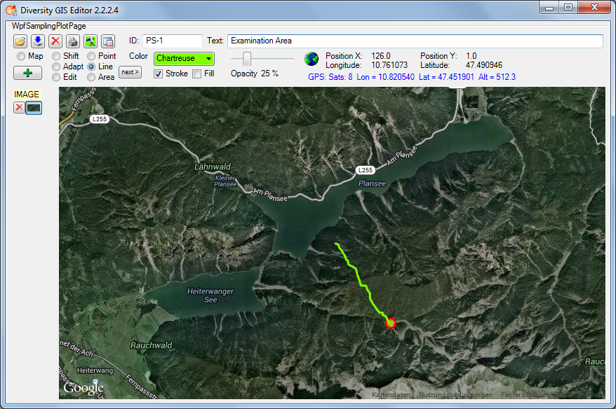
The number of satellites, longitude, latitude and altitude delivered
from the GPS device are displayed in the info line of the Control Panel
beneath the status.
The current position will be shown by a GPS marker
 if an appropriate background map has
been loaded. If GPS Track in the Settingswindow is checked, the movement of the position
will be drawn as a line string on the background map. The color and
stroke thickness are similar to the last adjustment for lines. When
switching off the GPS button again, the track will be added to the
sample list automatically and could be saved for future documentation
purposes.
if an appropriate background map has
been loaded. If GPS Track in the Settingswindow is checked, the movement of the position
will be drawn as a line string on the background map. The color and
stroke thickness are similar to the last adjustment for lines. When
switching off the GPS button again, the track will be added to the
sample list automatically and could be saved for future documentation
purposes.